Vehicle Controls & Behaviors
Annual PlanRobust Terrain Identification and Path Planning for Autonomous Ground Vehicles in Unstructured Environments
Project Team
Government
Paramsothy Jayakumar, William Smith, U.S. Army GVSC
Industry
Andy Diepen, Kevin Hubert, GS Engineering
Student
Sam Kysar (MS 2020), Akhil Kurup (PhD 2021), Zach Jefferies (PhD SMART), Casey Majhor (PhD SMART), Michigan Tech
Project Summary
Project started in 2018 and completed 2021 Q2.
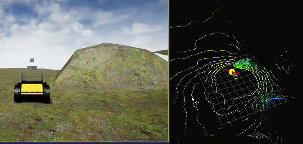
Autonomous navigation by robots in challenging terrain and varying environmental conditions remains a difficult and open research problem. The goal of this project is a robust motion planning system for ground robots. Most autonomous robot systems are bespoke; hand-tuned and optimized for a specific platform and set of operating conditions. By robust, we mean to say that the system can be easily adapted to perform on a variety of platforms and over a range of conditions. Implicit here is that the autonomous navigation system must apply a certain level of self-supervised tuning of system parameters that react to changes in platform (i.e. loss of functionality) or environmental conditions (i.e. change in terrain due to weather).

The aim of this research project is two-fold:
- The development of a robust motion planner capable of plotting a feasible trajectory through challenging non-planar terrain between arbitrary start and goal positions in a predefined map.
- Assuming an autonomous robot system equipped with a camera and LiDAR system what is the effect on performance (either in terms of completion rate or overall path length) of a reduction in sensor resolution. Accordingly, understanding the minimum resolution required to complete a task (in this case traversing a known trajectory) we also better understand the necessary level of redundancy.
Our approach avoids the pitfalls of other learning methods by using geometric features to ensure safety and online learning methods to improve completion rate.
Publications:
- Kysar, S., Bos, J., Kurup, A., Jeffries, Z. et al., “Unstructured with a Point: Validation and Robustness Evaluation of Point-Cloud Based Path Planning,” SAE Technical Paper 2021-01-0251, 2021
- Pandey, V., Bos, J., Ewing, J., Kysar, S. et al., “Decision-Making for Autonomous Mobility Using Remotely Sensed Terrain Parameters in Off-Road Environments,” SAE Technical Paper 2021-01-0233, 2021.
- Kurup, A., Kysar, S., Bos, J., Jayakumar, P., & Smith, W. (2021). Supervised Terrain Classification with Adaptive Unsupervised Terrain Assessment. SAE Technical Paper, 01-0250.
- Kysar Sam, et al. “C-SLAM: Six degree of freedom point cloud mapping for any environment”, Proc. SPIE 11415, Autonomous Systems: Sensors, Processing, and Security for Vehicles and Infrastructure 2020, 114150E
- Parker Young, Sam Kysar, Jeremy P. Bos, “Unreal as a simulation environment for offroad autonomy.” Proc. SPIE 11415, Autonomous Systems: Sensors, Processing, and Security for Vehicles and Infrastructure 2020, 114150F
- Akhil Kurup, Sam Kysar, Jeremy P. Bos, “SVM based sensor fusion for improved terrain classification”,” Proc. SPIE 11415, Autonomous Systems: Sensors, Processing, and Security for Vehicles and Infrastructure 2020, 114150G
- Kysar, Sam, et al. “Localization and mapping performance of two LiDAR systems in unstructured environments.” Autonomous Systems: Sensors, Processing, and Security for Vehicles and Infrastructure 2019. Vol. 11009. International Society for Optics and Photonics, 2019.
#1.28

